Does Nira support georeferenced files?
Written By Nira.app
Last updated About 3 hours ago
Yes. For optimal utilization of all Nira's capabilities, it is advised to export your files with georeferenced coordinates. If you intend to employ georeferenced coordinates, it is essential to identify a suitable coordinate system for your project. Here's a guide on how to do so:
• Choose a UTM Zone if you're not sure which coordinate system to use:
For photogrammetry assets, simply drag one of your photos into the UTM Zone Identification webpage and make note of the EPSG code displayed. You'll need this code when configuring your export.
• If you already have a preferred coordinate system:
Be sure it's cartesian. To verify, consult the EPSG number on https://epsg.io.confirm the presence of "Coordinate System: Cartesian 2D CS". For instance, the page for EPSG:28992 indicates that is cartesian, whereas EPSG:4326 is not. If your preferred coordinate system is not cartesian, you should use a UTM Zone instead -- see the first bullet point above to learn how.
Compound coordinate systems and Esri codes
Nira recognizes compound coordinate systems declared in photogrammetry metadata, including a horizontal projection paired with a vertical datum. It also recognizes ESRI: coordinate system codes declared directly in metadata or in a projection file's WKT. These codes are useful for coordinate systems whose required units are published under an Esri identifier.
Include the metadata or projection files from your export so Nira can georeference the asset and apply the correct measurement units. EPSG-coded uploads remain supported. All files intended to align must still describe a consistent coordinate system; automatic detection does not correct contradictory source coordinates.
What advantages can I derive from utilizing georeferenced data?
- Callouts will display WGS 84 Latitude, longitude, and altitude coordinates within Callout window and PDF Report
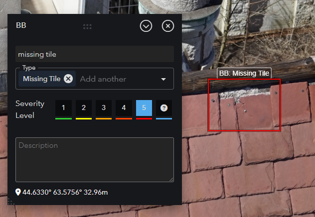
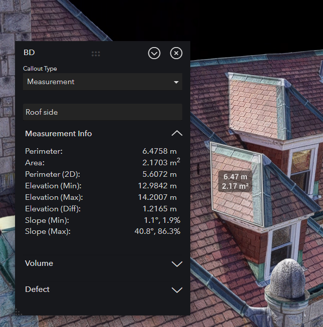
- More measurement data
- Slope
- Elevation Min, Max, and Difference
- Elevation profiles (coming soon)
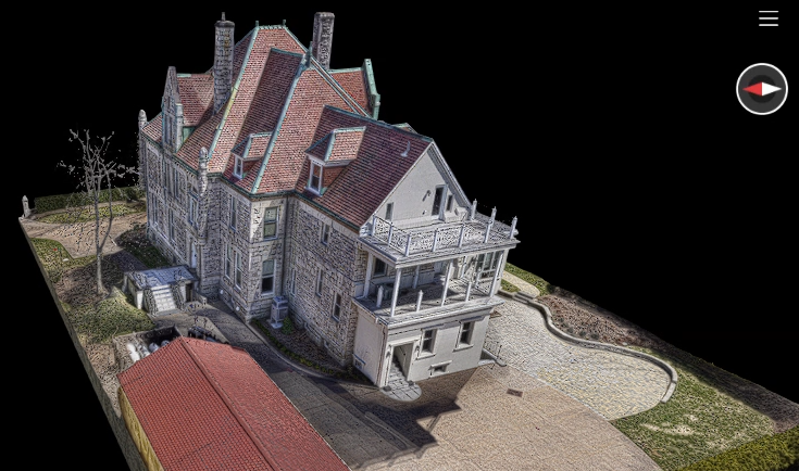
- View measurements and callouts created in 3D over the 2D orthomosaic; DXF linework is supported as a 2D map overlay
- Interactive Compass
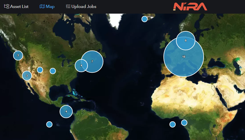
- Map View
- Surrounding Map Tiles as background layer (coming soon)
- Day/Night Lighting system with shadow analysis (coming soon)
- Import and export annotation and measurement data as CSV, TSV, or JSON on Growth and Enterprise plans; see annotation data import and export. CAD data interchange remains separate future work.
What's next?
Now that you've chosen your coordinate system, it's time to export your data. For application specific export and upload guides, see the Export Guides section of the Nira documentation.
Adding location data to a non-georeferenced model for Map View placement
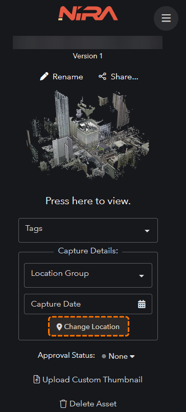
If your model is missing the required geofenced data (typically a metadata.xml or .rsinfo file), you can manually set the location by clicking Change Location.
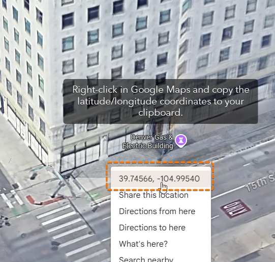
To identify the location, we recommend using Google Maps. Just right-click on the map and copy the latitude/longitude coordinates to your clipboard.
Paste the latitude and longitude coordinates back into Nira.
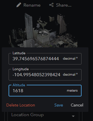
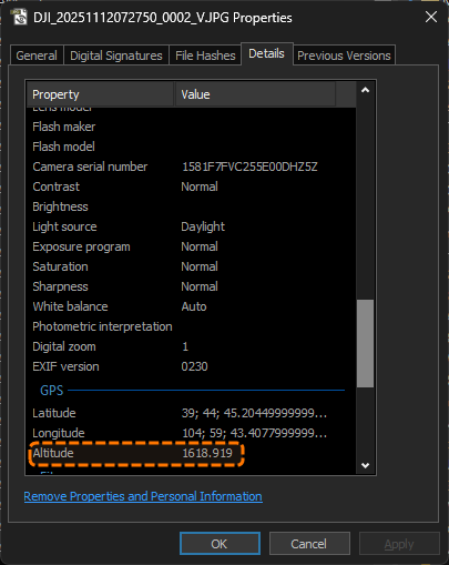
Keep in mind, Google Maps doesn’t provide altitude data, so enter whatever value makes the most sense or reference the altitude from your photo GPS metadata or use the altitude data from Google Earth.
Adding location data will only assist with placing your asset location in the map gallery. In the 3D viewer, the coordinates will still be shown as local rather than georeferenced. We do plan to introduce more advanced georeferencing support in Nira, but for now we recommend uploading the required files that automatically apply georeferencing, as outlined at the beginning of this help article.